


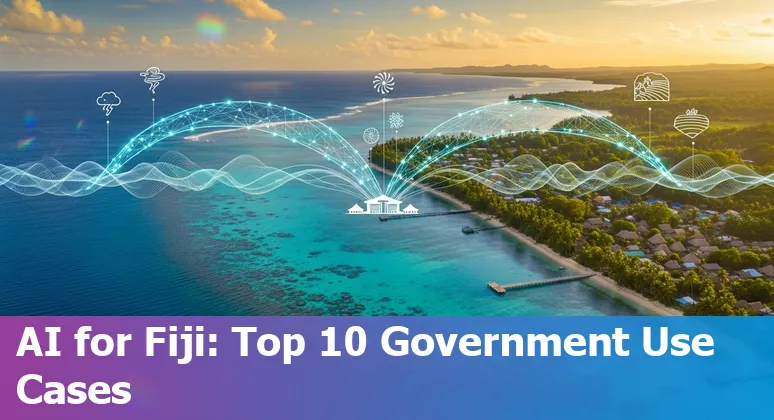
Top 10 AI Prompts and Use Cases and in the Government Industry in Fiji
Last Updated: September 8th 2025
Too Long; Didn't Read:
Practical AI prompts and use cases for Fiji's government focus on disaster early‑warning, coastal climate‑risk mapping, multilingual citizen services, energy transition planning (10% annual renewable capacity trade‑off), MRV for NDCs, and climate finance - backed by 24 GIS trainees and US$9.9m seed leveraging ~US$50m.
Fiji's island ministries face familiar pressures - data overload, stretched staff and urgent climate and service delivery challenges - so practical AI can be a game-changer if deployed with care: think conversational e‑portals that simplify discovery and work over low‑data channels like SMS or voice, not just flashy dashboards, as outlined in a recent Center for Global Development analysis of generative AI for e-government portals.
The Government AI Readiness Index (Oxford Insights) shows every country, including Pacific states, must align strategy, governance and data capacity before scaling tools, so Fiji can prioritize high‑impact pilots - disaster early‑warning, multilingual citizen services, and energy planning - while building skills locally.
Upskilling public servants is essential; short, work‑focused programs such as the AI Essentials for Work bootcamp teach prompt writing and practical AI skills that help teams move from pilot to production without losing sight of transparency, privacy and local priorities.
| Attribute | Information |
|---|---|
| Description | Gain practical AI skills for any workplace. Learn how to use AI tools, write effective prompts, and apply AI across key business functions, no technical background needed. |
| Length | 15 Weeks |
| Courses included | AI at Work: Foundations, Writing AI Prompts, Job Based Practical AI Skills |
| Cost | $3,582 during early bird period, $3,942 afterwards. Paid in 18 monthly payments, first payment due at registration. |
| Syllabus | AI Essentials for Work bootcamp syllabus |
| Registration Link | Register for the AI Essentials for Work bootcamp |
Table of Contents
- Methodology: How these Top 10 Use Cases were Selected
- Coastal Climate-Risk Mapping & Adaptation Planning
- Real-Time Disaster Early-Warning and Impact Forecasting (Fiji NDMO use)
- National Energy Transition & Renewables Planning (Island Grid Optimization)
- Land-Use, Agriculture Resilience & Food Security AI Assistant
- Mangrove & Blue-Carbon Restoration Planning
- Forest Monitoring, REDD+ & Land-Tenure Enforcement
- Short-Lived Climate Forcers (SLCF) Targeting with Health Co-Benefits
- Climate Finance Mobilization & De-Risking Instrument Design
- Behavioural & Policy Acceptability Modeling for Climate Measures
- MRV Assistant for NDC Tracking and Reporting
- Conclusion: Getting Started with AI in Fiji's Government
- Frequently Asked Questions
Before scaling any system, agencies must address the data protection gaps in Fiji that expose citizens to privacy and legal risks.
Methodology: How these Top 10 Use Cases were Selected
(Up)Selection of Fiji's top ten AI use cases followed a practical, government‑ready rubric drawn from public‑sector guidance: pick problems with clear mission impact and measurable outcomes, verify data readiness and lifecycle controls, screen for governance and security risks (confidentiality, integrity, availability), and prefer pilots that deliver quick wins while building lasting capacity.
This approach mirrors recommendations in the GSA's AI Guide for Government on starting with mission‑focused prototypes and embedding teams like Integrated Product Teams and central technical resources, and it echoes civil‑society calls for transparent AI inventories that document purpose, data and testing for every system (GSA AI Guide for Government - comprehensive guide to starting AI projects in government; Best Practices for Public Sector AI Use Case Inventories - consumer technology & digital rights guidance).
Governance tooling and frameworks (risk registers, explainability checks, role‑based ownership) were used to deprioritize high‑risk or low‑data ideas, while equity and scalability filters ensured each recommended use case could be explained to communities across Fiji's islands and grown without stranding local teams or budgets.
| Criterion | Why it matters |
|---|---|
| Mission impact | Prioritizes problems that directly improve service delivery or climate resilience |
| Data readiness | Ensures training and monitoring data exist and are documented |
| Governance & security | Assesses confidentiality, integrity and availability risks |
| Equity & transparency | Requires inventories and user‑facing explanations for trust |
| Feasibility & cost | Favors pilots with rapid, low‑cost proof of value |
| Scalability & workforce | Checks that local teams and central resources can sustain scale |
Coastal Climate-Risk Mapping & Adaptation Planning
(Up)Coastal climate‑risk mapping in Fiji is moving from static maps to operational, decision‑ready tools that help planners and communities weigh tradeoffs - from preserving mangroves to identifying where relocation may be unavoidable.
Recent capacity building through the MACBLUE GIS workshop in Suva trained 24 government representatives to map mangroves and seagrass using open‑source QGIS and the MACBLUE plugin with satellite inputs from Digital Earth Pacific, strengthening the on‑island skills needed to guide coastal planning and disaster preparedness (MACBLUE GIS capacity‑building workshop in Suva).
Combined with the Climate Change Division's web apps and UNOSAT decision‑support layers - sea‑level rise scenarios, mangrove extent from Sentinel‑2, and an adaptation projects tracker - these tools create evidence that can prioritise nature‑based defenses, target financing, and show exactly how far inland a village may need to move as risks evolve (Fiji Climate Change Division GIS decision‑support platform).
| Attribute | Information |
|---|---|
| Workshop | MACBLUE GIS Capacity‑Building Workshop |
| Venue & dates | Novotel, Suva - 16–20 June 2025 |
| Participants | 24 Fiji government representatives |
| Tools & data | QGIS, MACBLUE plugin, Digital Earth Pacific, Sentinel‑2 |
| Purpose | Map/monitor mangroves & seagrass, inform coastal planning and resilience |
“Climate change has alienated the indigenous from their land, and it's a terribly emotional subject. Geospatial information and technology can assist the government in very difficult conversations.” - Nazhat Shameem Khan, Fiji's permanent representative to the United Nations in Geneva
Real-Time Disaster Early-Warning and Impact Forecasting (Fiji NDMO use)
(Up)Real‑time early‑warning in Fiji now stitches together sensor networks, impact‑based forecasts and community tools so the National Disaster Management Office (NDMO) can turn warnings into rapid, local action: the Fiji Seismological Network's six remote satellite stations stream continuous data to the Suva hub and feed into multi‑hazard pipelines, while pilots like the NDMO's geoBingAn mobile app proved in PacWave2018 that geotagged evacuation reports give the National Emergency Operations Centre live situational awareness for schools and villages (UNDRR case study on multi‑hazard early warning systems in Fiji; NDMO's geoBingAn mobile app for tsunami drills).
Advanced coastal forecasting from projects such as the CIFDP integrates atmospheric, hydrodynamic and reef models to deliver impact‑focused guidance - in practice giving forecasters multi‑day lead time, rapid revisions and precise flood and storm‑surge estimates (used to estimate ~6.5m surge during Cyclone Harold) - and regional initiatives (CREWS, EW4All) are now layering AI to sharpen detection, tailor warnings for vulnerable groups, and close the last‑mile gap (CIFDP/forecasting overview).
The payoff is simple and visceral: a clear, locally relevant alert can change a family's decision to evacuate and save lives.
“For example, if there is a tropical cyclone and the forecast says to anticipate 50km/h winds, this information alone may not be understood by a layman. However, if we integrate the anticipated or possible impact by saying that this wind strength is capable of ripping off roofs and uprooting trees, it can be more relatable to people and they can then take action based on that information.” - Ms Ana Sovaraki, FMS Media Liaison Manager
National Energy Transition & Renewables Planning (Island Grid Optimization)
(Up)Island grid optimization in Fiji starts with the concrete: a USP/PCREEE techno‑economic analysis used the HOMER (Hybrid Optimisation Model for Electric Renewables) simulator to model wind/solar PV/diesel hybrids for remote communities, showing an entirely renewable configuration can be feasible if a 10% annual capacity shortage is tolerated, while a zero‑shortage scenario still needs a diesel generator - and that adding renewables cuts greenhouse gases (potentially monetisable through carbon trading) (HOMER-based hybrid mini-grid analysis (USP/PCREEE)).
The report draws on site data such as Nabouwalu wind speeds and regional solar radiation to produce optimal system graphs and cost tables, giving planners the quantitative backbone to weigh tradeoffs between reliability, cost and emissions; pair that backbone with AI‑enabled budgeting and scenario tools to speed comparisons and surface the lowest‑risk pathways for island utilities and communities (AI Essentials for Work bootcamp syllabus - AI-driven government budgeting use cases).
Picture a diesel genset largely idle through the sunny season because a tuned mix of PV and wind, chosen from hundreds of simulations, is reliably meeting village needs - that concrete image is the
so what
| Attribute | Information |
|---|---|
| Study | Techno‑economic analysis of a hybrid mini‑grid system for Fiji Islands (USP/PCREEE) |
| Tool used | HOMER (Hybrid Optimisation Model for Electric Renewables) |
| Key finding | All‑renewable feasible with 10% annual capacity shortage; diesel required for no‑shortage case |
| Data inputs | Wind & solar radiation (including Nabouwalu), load profiles, power curves |
| Benefits noted | Reduced greenhouse gas emissions; potential for carbon trading |
| Year | 2012 |
that makes optimization matter.
Land-Use, Agriculture Resilience & Food Security AI Assistant
(Up)An AI assistant for land‑use, agricultural resilience and food security in Fiji would act like a smart Ag Climate Dashboard tailored to island realities - combining short‑ and long‑range outlooks, pest and disease risk tools, growing‑degree calculations and downloadable local datasets so planners and extension officers can turn climate signals into clear, low‑bandwidth advisories over SMS or voice.
Tools such as the Ag Climate Dashboard show how integrated forecasts (7‑day, monthly and seasonal), historical climatologies and crop/pest models can inform planting windows, irrigation and risk evaluation; mirroring those capabilities for Fiji - linked to national data and the Fiji National Digital Strategy - Using AI in Government (2025) - could automate tailored alerts for districts, surface high‑risk areas for food insecurity, and free officers from manual data sifting so they focus on action.
This is practical tech, not hype: when forecasts and decision tools are packaged as plain‑language advice, the result is a timely nudge that can preserve a season's harvest.
| Feature | Role for a Fiji AI Assistant |
|---|---|
| Forecasts (7‑day, monthly, seasonal) | Trigger short‑term advisories and seasonal planning |
| Pest & disease forecasting | Prioritise scouting and targeted interventions |
| Climatologies & historical data | Contextualise anomalies and guide adaptive practices |
| Interactive decision tools | Translate model outputs into farm‑level recommendations |
| Downloadable local data | Support monitoring, reporting and local research |
Mangrove & Blue-Carbon Restoration Planning
(Up)Mangrove and blue‑carbon restoration planning in Fiji can start from a surprisingly tangible source: century‑old maps that, when compared with modern imagery, reveal long arcs of coastal habitat change and areas of mangrove loss that still matter for carbon, fisheries and shoreline protection - an insight underscored by a century and a half habitat‑change study (see the PubMed summary PubMed study on century‑and‑a‑half coastal habitat change in Fiji) and related ESF project notes tracing historical coastline shifts (ESF historical maps project report on coastline shifts).
Notably, the research flags places like Savusavu where shoreline hardening rose but mangrove cover did not decline, a reminder that local drivers vary and that restoration must be targeted, not one‑size‑fits‑all.
Pairing these long‑term baselines with decision tools and AI‑enabled prioritization aligned with the Fiji National Digital Strategy can help planners sequence interventions, estimate blue‑carbon gains and focus scarce funding where nature‑based defenses will matter most - turning old paper maps into actionable priorities for communities and coastal managers (see the Fiji National Digital Strategy 2025–2030 guidance Fiji National Digital Strategy 2025–2030).
Forest Monitoring, REDD+ & Land-Tenure Enforcement
(Up)For Fiji's forests, where cloud cover, patchy patrols and small landholdings make oversight hard, satellite radar combined with optical time‑series and machine learning can turn remote sensing into enforceable evidence for REDD+, MRV and land‑tenure cases: Sentinel‑1 SAR sees through clouds and at night, multitemporal change‑detection methods that fuse SAR with optical and VIIRS nighttime lights can distinguish subtle degradation from cleared land, and deep‑learning or clustering approaches expand the kinds of “change” that can be detected beyond simple loss (multitemporal SAR + optical change detection study).
Synthetic Aperture Radar's physics also matters for forests - longer wavelengths (L‑band) penetrate canopy to sense trunk and biomass while C‑band is the global workhorse for mapping and change‑detection - an elegant trick that simulates an antenna “over 47 football fields” long to gain high resolution regardless of daylight or weather (NASA: Synthetic Aperture Radar (SAR)).
Practical monitoring pipelines described in industry reviews show how SAR/optical fusion and InSAR‑based change products can flag encroachment, prioritise field inspections for tenure disputes, and feed transparent REDD+ reports - turning repeat satellite passes into a cheap, island‑wide forest audit that directs scarce enforcement effort where it will matter most (SAR & optical asset‑monitoring overview).
| SAR Band | Typical application |
|---|---|
| L‑band | Biomass and vegetation mapping; deeper canopy penetration |
| C‑band | Global mapping and change detection; SAR workhorse for forests |
| X‑band | High‑resolution urban/ice monitoring; surface‑dominated backscatter |
Short-Lived Climate Forcers (SLCF) Targeting with Health Co-Benefits
(Up)Targeting short‑lived climate forcers (SLCFs) is a practical lever for Fiji to make measurable climate progress that also improves community health: trimming these near‑term pollutants can move the needle toward the country's stated Nationally Determined Contribution of a 30% emissions reduction by 2030 while delivering tangible air‑quality benefits for island towns and villages (Fiji NDC & policy portal).
AI can sharpen that effort by spotting emissions hotspots from heterogeneous data, prioritising interventions by cost‑effectiveness, and automating low‑bandwidth alerts to frontline health and environment teams so scarce resources go where they save the most harm; practical examples of AI cutting public‑sector costs and speeding analysis are discussed in Nucamp's overview of AI‑driven government efficiencies (How AI is helping government companies in Fiji cut costs).
To sustain and scale targeted SLCF programs, the workforce needs quick, job‑focused reskilling - short data and coding courses can equip local staff to run and interpret AI tools - and those efforts should sit inside the Fiji National Digital Strategy so interventions are responsible, interoperable and locally owned (Fiji National Digital Strategy 2025–2030).
Climate Finance Mobilization & De-Risking Instrument Design
(Up)Mobilising climate finance in Fiji means moving beyond one‑off grants to smart blended structures that crowd in domestic banks, pension funds and local investors by lowering risk and building a pipeline of investable projects - think concessional tranches, guarantees and a Technical Assistance Facility that turns community ideas into bankable businesses.
Practical Fiji examples show the model: a 2022 Fiji sovereign blue bond and GFCR-backed deal flow (where partners like Matanataki are even evolving into women‑led fund managers) illustrate how blended finance can seed reef‑positive enterprises and scale sanitation or eco‑fertiliser factories, while the Joint SDG Fund's work aims to leverage roughly US$50m from an initial US$9.9m commitment to mobilise private capital for 30 Locally Managed Marine Areas and other blue‑economy ventures (blended finance for coastal resilience; GFCR's blended finance approach in Fiji).
De‑risking also requires practical tools - TAFs, project standards and market‑friendly revenue models - and can be accelerated by AI for rapid project screening and budgeting, as explored in Nucamp's overview of AI‑driven government efficiencies (Nucamp AI Essentials for Work: AI for public budgeting and deal origination).
The payoff is concrete: locally anchored capital that sustains livelihoods, restores reefs and turns fragile projects into resilient, investable businesses.
| Instrument / Initiative | Fiji example / detail |
|---|---|
| Joint SDG Fund + GFCR seed | US$9.9m initial investment aiming to leverage ~US$50m |
| LMMAs blended facility | US$10m for private sector investment in 30 LMMAs |
| Sanitary landfill blended facility | US$14m public‑private project |
| Eco‑fertiliser pilot | US$0.75m UN investment (replicable model) |
| Matanataki pipeline examples | Project ticket sizes: US$500k–10m (varies by enterprise) |
| Parametric microinsurance (PICAP) | 1,388 households covered in 2021; scaling to ~4,000 targeted |
Behavioural & Policy Acceptability Modeling for Climate Measures
(Up)Behavioural and policy‑acceptability modeling can help Fiji's ministries predict how communities, civil society and local leaders will react to climate measures before costly roll‑outs - testing messaging, trade‑offs and compensation packages in silico so decisions reflect local values and avoid backlash.
Models that blend survey data, stakeholder mapping and low‑bandwidth sentiment signals can surface where a proposed carbon pricing or offset scheme might run into resistance: the Pacific Islands Climate Action Network's submission flags that carbon‑market designs which implicitly permit continued fossil‑fuel use risk undermining trust and must safeguard FPIC and independent governance (Pacific Islands Climate Action Network submission on the Fiji carbon market roadmap).
With government documents already suggesting Fiji “may introduce a carbon tax” in the medium term, scenario testing can show which combinations of pricing, rebates and visible renewable investments are most likely to win public buy‑in without displacing vital grant finance (Carbon Pulse: Fiji considers carbon pricing policies in latest budget).
Embedding these models inside the Fiji National Digital Strategy and pairing them with practical AI tools - used responsibly to stress‑test policies and craft plain‑language outreach - turns abstract tradeoffs into concrete, culturally attuned plans that reduce surprises and help scale measures that communities actually accept (Fiji National Digital Strategy 2025–2030: guide to using AI in Fiji government).
MRV Assistant for NDC Tracking and Reporting
(Up)An MRV Assistant for Fiji would turn scattered sectoral reporting into a single, auditable workflow - automating the collection, QA/QC and IPCC‑consistent calculations that underpin NDC tracking and national communications.
Recent transport MRV work shows how streamlined sector systems can collate mitigation, adaptation and finance data for clearer GHG accounting (Pacific NDC Hub: transport MRV in Fiji), while agriculture capacity building with GHGMI and ICAT is teaching national experts to apply the 2006 IPCC methods so emission estimates are locally robust (GHGMI: agriculture MRV training).
Coupling those advances with the ACIAR Tier‑2 livestock project - complete with SF6 field measurements and protocols - lets an AI assistant convert on‑farm data and sensor logs into policy‑ready inventory lines that are transparent to auditors and attractive to funders (ACIAR: Tier‑2 livestock MRV for Fiji).
The practical outcome is simple: faster, defensible NDC reporting, clearer evidence of what policies work, and a measurable boost to Fiji's ability to access climate finance by showing credible, timely results.
| Attribute | Detail |
|---|---|
| Project | Tier‑2 MRV system for livestock (ACIAR CLIM/2021/160) |
| Location | Fiji |
| Duration | Oct 2023 – Nov 2025 |
| Budget | AUD 735,278 |
| Key methods | SF6 methane measurements; Tier‑2 emission factors; IPCC 2006 guidance |
| Partners | Riverine Plains Inc, Agriculture Victoria, Fiji National University, Ministry of Agriculture, USP, QUT |
Conclusion: Getting Started with AI in Fiji's Government
(Up)Getting started with AI in Fiji's government means pairing fast, mission‑focused pilots with clear governance and workforce plans: as of May 2025 Fiji has not enacted a comprehensive national AI law, so integrating AI oversight into the National Digital Strategy and cybersecurity workstream is essential (Artificial intelligence law in Fiji).
Practical governance playbooks - catalogue systems, run risk registers, and form a cross‑functional AI committee - help translate regulation into day‑to-day controls; resources like OneTrust offer step‑by‑step frameworks for operationalising those measures (OneTrust guide: Getting started with AI governance).
At the same time, invest in short, work‑focused reskilling so ministry teams can run pilots, audit outputs and explain decisions to communities; a 15‑week, job‑oriented course like Nucamp's AI Essentials for Work teaches prompt skills and practical AI workflows that let small teams move from proof‑of‑concept to reliable public services without outsourcing control (AI Essentials for Work syllabus).
Start small, document everything, and anchor every project in clear public value - those three moves will keep AI useful, auditable and locally owned.
| Attribute | Information |
|---|---|
| Description | Gain practical AI skills for any workplace; learn tools, prompt writing, and apply AI across business functions |
| Length | 15 Weeks |
| Courses included | AI at Work: Foundations, Writing AI Prompts, Job Based Practical AI Skills |
| Cost | $3,582 during early bird period, $3,942 afterwards (paid in 18 monthly payments) |
| Syllabus | AI Essentials for Work syllabus |
| Registration | AI Essentials for Work registration |
Frequently Asked Questions
(Up)What are the top AI use cases and prompts recommended for Fiji's government?
The article recommends mission‑focused, practical AI use cases for Fiji, including: 1) conversational e‑portals and low‑bandwidth prompts (SMS/voice) for multilingual citizen services; 2) coastal climate‑risk mapping and adaptation planning; 3) real‑time disaster early‑warning and impact forecasting (NDMO use); 4) national energy transition and island grid optimization; 5) a land‑use/agriculture resilience and food‑security AI assistant; 6) mangrove and blue‑carbon restoration planning; 7) forest monitoring, REDD+ and land‑tenure enforcement using SAR/optical fusion; 8) targeting short‑lived climate forcers (SLCFs) with health co‑benefits; 9) climate finance mobilization and de‑risking instrument design; and 10) behavioural and policy‑acceptability modeling plus an MRV assistant for NDC tracking and reporting. Each use case pairs actionable prompts (e.g., “generate plain‑language evacuation guidance for village X”) with practical delivery channels and measurable outcomes.
How were the top 10 use cases selected?
Selection followed a government‑ready rubric: prioritize clear mission impact and measurable outcomes; verify data readiness and documented lifecycles; screen for governance, security and privacy risks (confidentiality, integrity, availability); apply equity and transparency filters (user‑facing explanations, inventories); and favor feasibility, low cost and scalability that local teams can sustain. The approach mirrors public‑sector guidance such as the GSA AI Guide and uses tooling like risk registers, explainability checks and role‑based ownership to de‑prioritize high‑risk or low‑data ideas.
Which pilots should Fiji prioritize first to get value quickly?
Prioritize high‑impact, low‑cost pilots that deliver quick wins and build capacity: 1) real‑time disaster early‑warning and impact forecasting (closing last‑mile alerts and tailored impact messaging); 2) conversational multilingual citizen services over SMS/voice to widen access; 3) coastal climate‑risk mapping and adaptation planning to inform relocations and nature‑based defenses; and 4) island grid optimization for renewable planning. These pilots are chosen for clear mission value, measurable benefits, and opportunities to scale while strengthening data and governance practices.
What governance, data and workforce steps are required before scaling AI across ministries?
Key steps: integrate AI oversight into the National Digital Strategy and cybersecurity workstreams; catalogue AI systems and form a cross‑functional AI committee; run risk registers, perform explainability checks and assign role‑based ownership; document data lifecycles, QA/QC and access controls; ensure transparency and community‑facing explanations; and invest in short, job‑focused reskilling so teams can audit, operate and sustain systems. Operational tools and playbooks (inventories, risk templates, explainability checklists) help translate policy into day‑to‑day controls.
What training is recommended for public servants and what are the course details and costs?
The article recommends short, work‑focused reskilling so staff move from pilots to production. Example: Nucamp's 15‑week, job‑oriented AI program (courses included: AI at Work: Foundations; Writing AI Prompts; Job‑Based Practical AI Skills). Cost: US$3,582 during early‑bird period and US$3,942 afterwards, payable in 18 monthly payments with the first payment due at registration. The curriculum emphasizes practical prompt writing, low‑bandwidth delivery patterns, and hands‑on workflows for non‑technical teams.
Build future‑proof skills in crisis analytics, GIS and parametric insurance skills to move from routine tasks into resilience planning.
Understand why a clear national AI readiness roadmap matters for ethical, secure and cost‑effective AI deployment in Fiji.

Ludo Fourrage
Founder and CEO
Ludovic (Ludo) Fourrage is an education industry veteran, named in 2017 as a Learning Technology Leader by Training Magazine. Before founding Nucamp, Ludo spent 18 years at Microsoft where he led innovation in the learning space. As the Senior Director of Digital Learning at this same company, Ludo led the development of the first of its kind 'YouTube for the Enterprise'. More recently, he delivered one of the most successful Corporate MOOC programs in partnership with top business schools and consulting organizations, i.e. INSEAD, Wharton, London Business School, and Accenture, to name a few. With the belief that the right education for everyone is an achievable goal, Ludo leads the nucamp team in the quest to make quality education accessible